
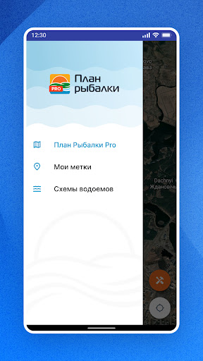
Features План Рыбалки PRO
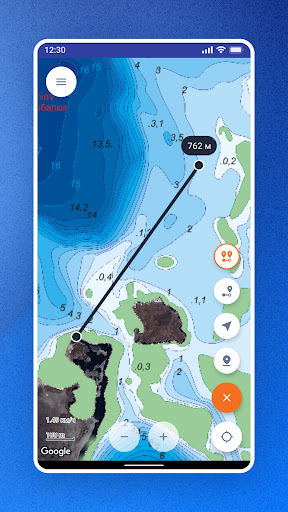
Fishing Plan - Schemes of the depths of water bodies in Belarus.Knowing the depth and topography of the reservoir allows you to find the best places for fishing and always stay with a good catch.
Now with the app "Fishing Plan" a complete depth chart is always with you in your smartphone and without an expensive fish finder.
With the help of the application, beginners and experienced anglers can easily navigate a large area and always accurately understand the bottom topography.Application features:- display of schemes of depths of reservoirs of Belarus (according to the list).- display of the current location by GPS.- display of speed and direction of movement.- saving points of interest.- creation of points by coordinates and editing.- displaying the distance scale and measuring the distance to the point.The application is free.Built-in depth chart.
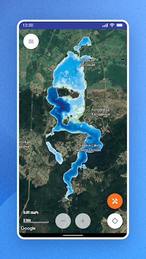
Vyacha (Minsk region).Depth charts of additional reservoirs are paid and are purchased in the application by subscription.Available Depth Charts: ind.
Zaslavskoye (Minsk Sea), vdkh.
Dubrovskoe (Raubichi, Prilepy), Petrovichskoe inlet, Drozdy inlet, Losvido lake, Selyava lake.
(type-B), Volchkovichskoe vdkh.
(Ptich), Yanovo Lake, Pleshchinitskoye Vdh.
(Voykovskoe), Svir lake.
(type-B), Vileyskoe vdkh.
(type-B), Lake Naroch (type-B), thermal power station-5 v-m., Sergeevichi (channel scheme), Soro lake.
(type-B), Boginskoye lake.
(type-B), Navoe pond, Strusto and Snudy lakes.
(type-B), Miastro and Batorino lakes.
(type-B), Selets vdh., Krinitsa vdh., Rudeya vdh.
and etc.There are two types of depth charts in the application.1.
Depth charts built entirely according to echolocation data.2.
Type-B depth charts - constructed partly from echolocation data and supplemented with topographic data from other sources.
Gaming Features
Enjoy immersive gaming experience with various game modes.
Fitness Tracking
Track your workouts and monitor your health metrics.
Travel Features
Plan and manage your travels with ease.
See the План Рыбалки PRO in Action
Get the App Today
Available for Android 8.0 and above